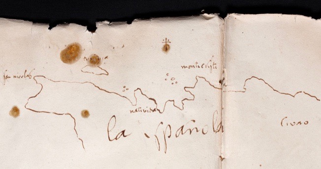
The island of Hispaniola, currently shared between the countries of Haiti and the Dominican Republic, straddles the boundary between the North American and the Caibbean plates. In 1912 already, J. Scherer, a Jesuit father located in Port-au-Prince, had identified three “depressions” (see figure below) that where seismically active. Scherer had indeed equiped Haiti with a seismic station located at the "Observatoire du Petit Séminaire du Collège Saint Martial”, which remained operational from 1908 to 1966. That earthquakes are the manifestation of sudden slip of a fault segment was not known at the time.
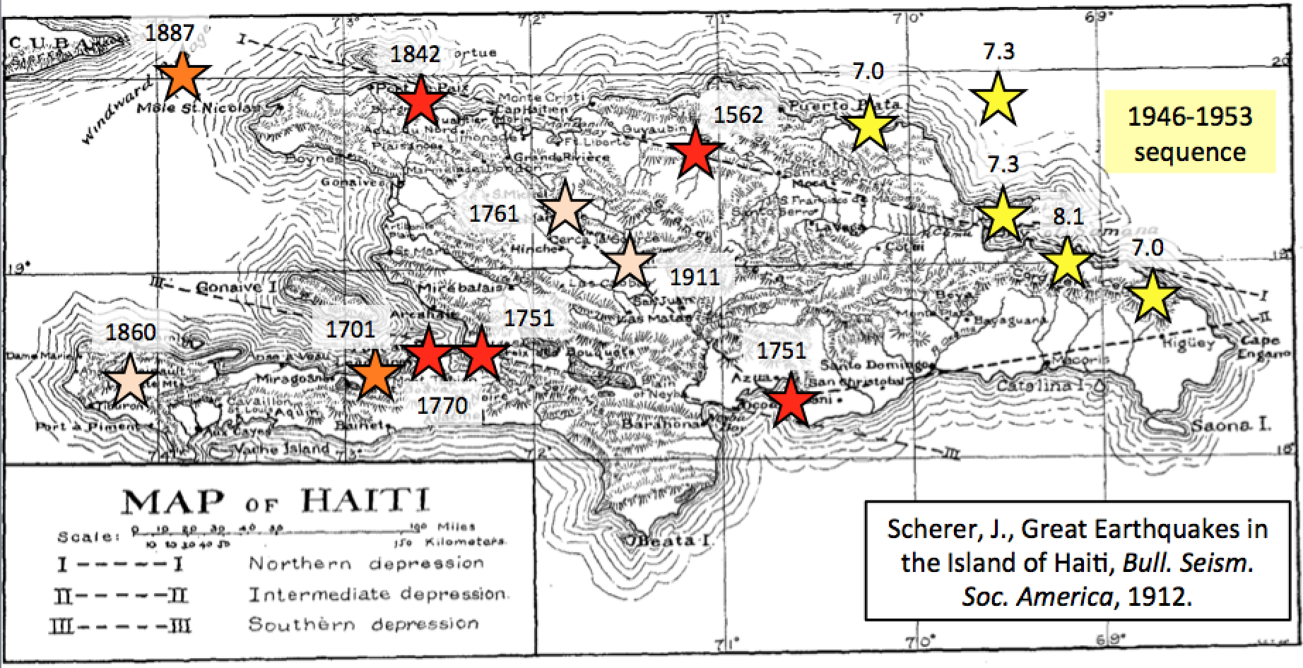
Figure: The island of Hispaniola and its three “depressions” (from Scherer, 1912) that are also the locale of most historical earthquakes in the region.
Today we know that the relative motion between the Caribbean and North American plates is distributed over several major active faults, along which most of the large historical earthquakes appear to be located: the north Hispaniola thrust fault and the Septentrional and Southern Peninsula (or Enriquillo Plaintain Garden) left-lateral strike-slip faults.The Mw7.0 earthquake that struck Haiti on January 12, 2010, was one of them located within the Southern Peninsula fault zone. It is likely that other active faults will be discovered as research progresses.
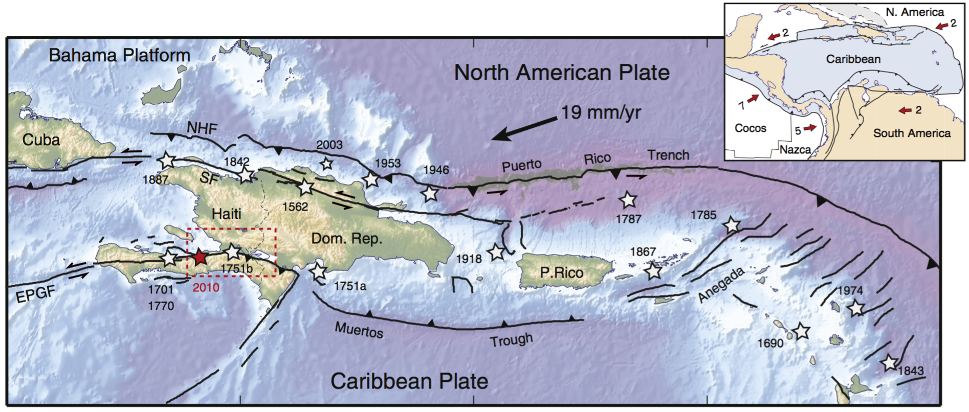
Figure: Current tectonic setting of the northeastern Caribbean. SF = Septentrional fault, EPGF = Enriquillo Plantain Garden Fault. Stars show large (Mb7) instrumental and historical earthquakes.
In 2003, we initiated GPS measurements in Haiti to complement measurements made in the Dominican Republic and Puerto Rico in the framework of the CANAPE project. The first results came out in 2008 in a paper where we wrote that "the Enriquillo fault in Haiti is currently capable of a Mw7.2 earthquake if the entire elastic strain accumulated since the last major earthquake was released in a single event today”. This was close to the scenario that unfolded in Haiti on January 12, 2010.
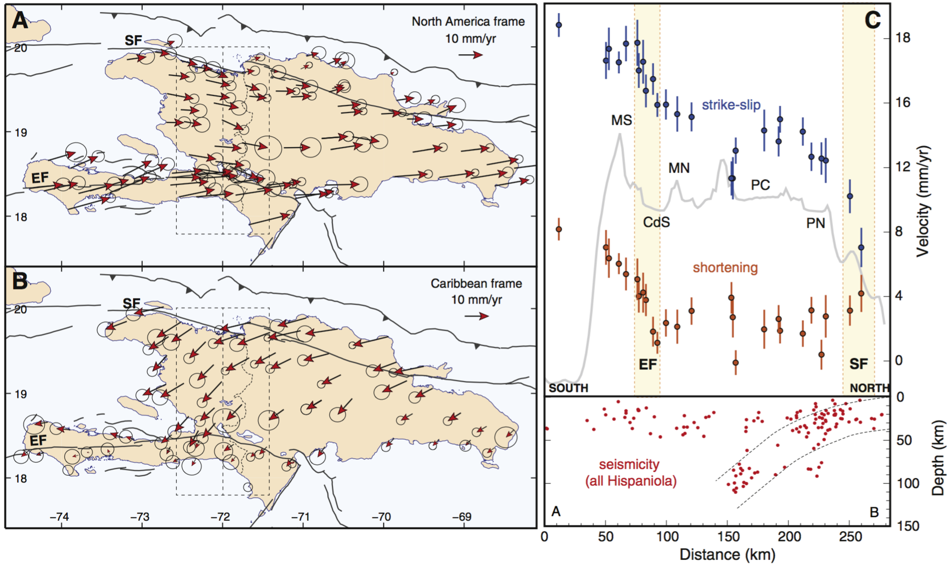
Figure: GPS velocities shown with respect to the North American plate (A) and to the Caribbean plate (B). Error ellipses are 95% confidence. (C) North–south profile including GPS sites shown with the dashed box shown on panels A and B. Velocities are projected onto directions parallel (blue) and normal (red) to the EPGF direction. MS = Massif de la Selle, CdS = Cul-de-Sac basin, MN = Matheux-Neiba range, PC = Plateau Central, PN = Plaine du Nord, EF = Enriquillo fault, SF = Septentrional fault. From Calais et al., 2016.
Amongst the important results that came out of the GPS measurements in Haiti and the Dominican Republic, was the evidence for a significant plate-boundary perpendicular shortening in south-central Hispaniola. This implies that the Southern Peninsula (Enriquillo) fault is not a pure strike-slip system as often described, bur rather a transpressional (in the west) to purely reverse (from Port-au-Prince eastward) fault system. Why does it matter? Because seismic hazard is highly dependent on the geometry of the potential seismic sources — an earthquake on a reverse fault through the Cul-de-Sac basin, that hots the captical city of Port-au-Prince — is a much more damaging scenario than the same one on a vertical strike-slip fault.
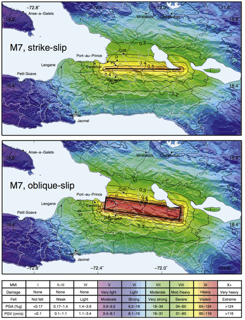
Figure: Ground motion scenarios illustrating the two end-member models discussed in the text. Thick black lines show the surface projection of the simulated rupture, of magnitude 7.0 in both cases. Solid contours show PGA in g. Background colors show modified Mercalli intensities calculated according to Wald et al. (1999). CdB = Croix des Bouquets, D = Delmas, PV = Pétionville. From Symithe and Calais, 2016.