Active tectonic structures along the northern Caribbean plate boundary from Cuba to Hispaniola delineate a narrow deformation zone dominated by left-lateral strike-slip faulting. The shear displacement appears to be concentrated along the Oriente fault. Its segmented trace, with left-stepping offsets, is responsible for the subsidence of local pull-apart basins (Cabo Cruz, Chvirico, Imias). South of the Oriente fault between 77W and 75W, the Santiago Deformed Belt is a narrow transpressive structure showing active folding and reverse faulting, consisten with earthquake focal mechanisms in this area.
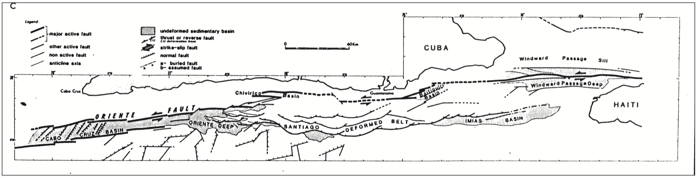
Figure: Main active faults mapped offshore the southerh Cuban margin. Note the left-stepping offsets along the main plate boundary fault (Oriente fault) and the presence of a narrow transpressive sliver (Santiago Deformed Belt) on the southern side of the Oriente Fault. From Calais et al., 1991, 1998.
In 1998, we interpreted Santiago Deformed Belt as indicative of "a component of convergence added to the shear displacement between the Caribbean and North America plates that would induce the transpressive strain regime and cause folding and reverse faulting along structures parallel to the main fault". We went further and used earthquake moment rate to "compute a seismic slip rate of 13–15mm/yr that agrees well with the 12 ± 3 mm/yr NUVEL-1 estimate along the northern Caribbean plate boundary". If correct, this result implies that all the slip along the southern Cuban margin occurs seismically and could suggest strong lithospheric coupling between the Caribbean and North America plates in that region.
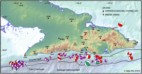
Figure: Map of GPS sites installed and measured in the framework of a collaborative project with the Cuban National Seismological Center (CENAIS) and with GEOCUBA. Earthquake focal mechanisms are from the gCMT catalog (red), Moreno et al. (purple), Perrot et al. (green), Doser et al. (blue).
In 2018, only (!) 20 years later, we initiated a project to measure crustal deformation in the Cuban Oriente using GPS measurements in order to test these old hypotheses. These GPS measurements also complement our mapping of plate boundary deformation in the northern Caribbean in an active area where no geodetic data was available until then.
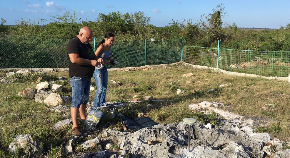
Photograph of the Cabo Cruz GPS site, installed here by Viana and Eduardo. The GPS antenna is mounted on a 0.5 m—tall stainless steel rod sealed into bedrock.
Photos of the 2018 GPS campaign