-- General context --
South East Asia is the locus of convergence of three plates, the Pacific, Austro-Indian, and European plates. This convergence which occurs at velocities of about 10 cm per year, and which has been going on for tens of millions of years, is the direct cause of the numerous earthquakes and volcanic eruptions which are grave natural hazards for the South East Asian countries. It has resulted in the bewildering complexity of the tectonics of this region with interactions of numerous deforming zones. Up to recent times, one only knew the velocities of the main plates from indirect measurements such as the oceanic crustal ages at mid-ocean ridges; these measurements give an average velocity over a few million years. One had no possibility to measure the velocity and deformation in tectonic areas directly.
In the last few years, major technological developments in space geodesy have completely changed the situation. Thanks to the american Global Positioning System (GPS), one can now directly measure the position of a given point, anywhere on the earth's surface, with a centimetric precision, at a relatively low cost. This new high precision technology introduces a major break-through in the field of earthquakes studies, as important as those developed in the wake of the plate tectonic theory, twenty five years ago.
Measuring positions at different successive times, one can obtain within a few years, the velocities of the main plates as well as of the minor plates, and define in this way the steady state (permanent) velocity field at the Earth's surface. This enables the precise evaluation of the seismic potential of the different zones. In addition, one can measure the transient (changing) velocity field in active tectonic zones reflecting elastic deformations which periodically result in earthquakes. This is of course of great importance for the understanding of earthquakes and to learn about the mechanical structure of the crust.
Thus, confronting the deformation pattern inferred from geodesy to the seismological information, one learns about the evolution of the instantaneous deformation leading to earthquakes. Comparing these results to geological studies of active faults, one can then extrapolate this deformation pattern for earthquake potential evaluation.
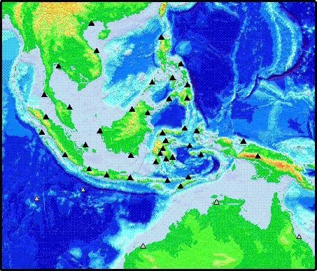
In October 1991, an Asean-EU workshop was organized in Jakarta, and, as a result, a program was proposed to study the effect of the convergence of three large plates on the natural hazards of South East Asia. To achieve this goal, a combined approach of these new space geodetic techniques and the already well known seismological methods (like seismic tomography), was proposed. This programme will measure the steady state velocity field at about fourty points over the whole South East Asia and will be fully completed in 1997.
-- Local densification --
A necessary complement of this large-scale programme is a more local study aimed at measuring the deformation where it actually occurs. For this purpose, and as a first step, we intend to establish a regional network (connected with the global network), to monitor local deformation in an earthquake prone area near the triple junction : the Sulawesi (Celebes) Islands. This relatively small network (up to ten to fifteen stations) will be fastly measured for the first time along with the larger network (November 1994).
The complete data set, including the data provided by the local network in the Sulawesi Islands, will be processed by DUT (Delft, Netherlands), GFZ (Potsdam, germany), IFAG (Frankfurt/M.), and ENS (Paris, France).
The structural geology and tectonics of the Sulawesi area will be studied by the geology group at Orsay university (France). Therefore the tectonic and geological implications will be drawn in collaboration with this group and the geodynamic group at ENS which will also work on the large scale geophysical implications. All further geophysical modelling of the regional area (precise description of the fault system, three dimensional deformation pattern, etc...) will be conducted by our geophysic group in collaboration with the four others.
-- Overall Project Schedule --
Sequence of Activity
Note: Phase C to G (inclusive) are to be repeated with each measurement sequence.
Schedule
| Phase A | Early 1993 |
| Phase B | October 1993 |
| Phase C | April 1994 |
| Phase D | November 1994 |
| Phase E | End of 1994 |
| Phase F | Early 1995 |
| Phase G | Year 1995 |
| Repeat C-D | March-April 1996 |
| Repeat F-G | End of 1996 |
| Phase H | Starting 1997 |