PERMANENT GPS STATION IN "TERRE ADELIE"
"Dumont d'Urville" Antarctic French base
|
 View from North
 View from South
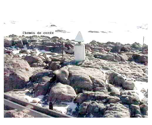
 View from East
 View from West
|
|
|
View from North
View from South
View from East
View from West
|
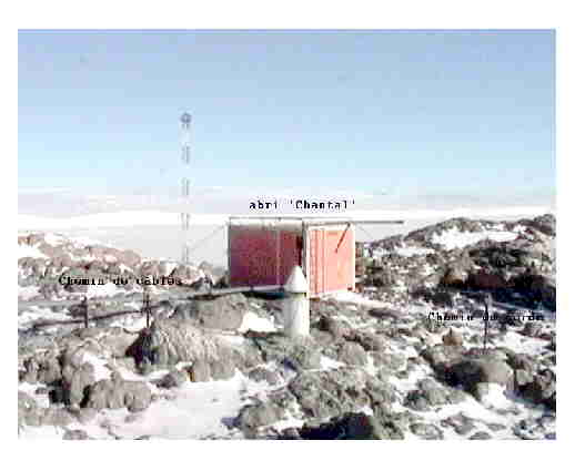
A permanent GPS station was installed at the French base in Antarctica : Dumont d'Urville in "Terre Adélie". This station is operationnel since end of december 1997, and provide daily files of 24 hours continuous measurements (Phase and codes on both frequencies) with sampling rate of 30 seconds since then. The data are archived and accessible through specific request to one of the partners involved (see section 9 of SITE INFORMATION FORM).
The station also operates a differential GPS (DGPS) broadcasting system. RTCM-104 peudo-range corrections are computed and transmitted in UHF (400 MHz). The radio antenna is installed on top of a 72 meters height mast, providing coverage of a 30 km wide zone. The system provides meter level accuracy in real time from hand-held receivers within this zone, simplifying many GPS survey tasks that would otherwise require time consuming collection and post-processing of data.
Future applications on a wider zone can be easely envisionned by installing UHF transcievers in the area. Applications requiring real time centimetric accuracy could also be envisionned, simply using the RTK phase corrections, also computed by the base station.
**********************************
SITE INFORMATION FORM
**********************************
0. Form
Prepared by (full name): Dr. Christophe Vigny, M.N. Bouin, F. Roubaud, M. Gervaise
Date : 02-March-1998
Report type : New
(NEW or UPDATE)
1. Site Identification of the GPS monument
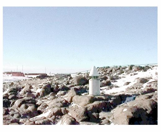
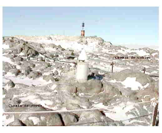
Site Name : Dumont d'Urville
4 char ID : DUM1
Monument Inscription : -
IERS DOMES Number : 91501M001
CDP Number : -
Date : 02-March-1998
Additional information :
2. Site Location
City : Antarctic base of "Dumont d'Urville"
Country : Terre Adélie, France
Tectonic Plate : Antarctica
Approximate Position
X coordinate (m) : -1940883.7791
Y coordinate (m) : 1628483.2535
Z coordinate (m) : -5833718.0282
Latitude (deg) : -66.66508447
Longitude (deg) : 140.00193350
Elevation (m) : -1.3806
3. GPS Receiver
Type : ASHTECH CGRS Z-12
Serial Number : 700845-10(F)-LP03030
Firmware Version : 1E95-1D01
Date : 20-December-1997
4. GPS Antenna
Type : ASHTECH CHOKE-RING 700936 revolution E
Serial Number : CR15276
Date : 20-December-1997
Vertical Antenna Height: 0.035
Antenna Reference Point: ARP 0.00
Date : 20-December-1997
5. Local Site Ties
Monument CDP DOMES Components Accuracy Date
Name Number Number dX dY dZ mm yy-mm-dd
............ ....... ........ ......
Differential coordinates from the GPS monument to the reference and
other monuments. The components are parallel to the XYZ-axes of the
global geocentric reference system ITRF (WGS-84).
"Accuracy" is estimated accuracy of local survey (millimeters).
6. Frequency standard
H-maser / / Cesium / / Quartz / / Internal / X /
Other (specify) :
Date :
(Mark with 'X')
7. Collocation
SLR / / VLBI / / DORIS / X / PRARE / /
Other GEOPHYSICAL Instrumentation (specify) :
Other (specify) :
(Mark with 'P' for permanent, 'M' for mobile collocation)
8. On-site, Point of Contact Agency Information
Agency : IFRTP
Contact : instrumentation team
Address : Dumont d'Urville, Terre Adélie
Telephone : None
E-mail : instrum@ifrtpddu.ifremer.fr
Fax : None
9. Responsible Operations Agency
9.1
Agency : IFRTP
Contact : D. Fleury
Address : IFRTP, Technopole Brest Iroise,
BP 75, 29280 Plouzané, France
Telephone : + 33 2 98 05 65 00
E-mail : Dominique.Fleury@ifrtp.ifremer.fr
E-mail : dfleury@ipev.fr
Fax : + 33 2 98 05 65 55
9.2
Agency : IGN
Contact : M.N. Bouin
Address : ENSG/LAREG - Cite Descartes
6 et 8, Av. Blaise Pascal
77455 Marne-la-Vallee Cedex 2, France
Telephone : + 33 1 64 15 32 61
E-mail : bouin@ensg.ign.fr
Fax : + 33 1 64 15 32 53
9.3
Agency : CNRS/ENS
Contact : C. Vigny
Address : Laboratoire de Géologie, ENS
24 rue Lhomond,
75231 Paris cedex 05, France
Telephone : + 33 1 44 32 22 14
E-mail : vigny@geologie.ens.fr
Fax : + 33 1 44 32 22 00
10. Please insert here the character graphics corresponding to the
antenna type. Check, complete or change if necessary the antenna
dimensions.
--
/ \
/ \
/ \
/ \
/ \
/ \
/ \
/ \
/ \
/ \
/ \
/ \
/ \
/ \
/ \
/ \
/ Ashtech: Dorne Margolin choke-ring \
/ \
/ ----- \ |
| / + \ | <-- 0.128 L2 |
| | + | | <-- 0.110 L1 |
+--------------------------------------------------+ <-- 0.102 TCR |
| | |
| | |
| | | Antenna
| | |
+-+--------------------------------------------------+-+ <-- 0.038 |
+-------------------+-------------+--------------------+ <-- 0.035 BCR |
| | |
=| | |
^ -------- +------x------+ <-- 0.000 ARP v
AH=3.5cm| | _|______reference pin ^
v ________ | / | <-- -.035 | Adaptor
| T | |
----------------------------I---------------------------- <-- -.050 v
| I | ^
| I | |
| I | |
| | | Pillar
| | |
| | |
| | |
| | |
<-- 0.381 -->
ARP: Antenna Reference Point
L1 : L1 Phase Center L2 : L2 Phase Center
TGP: Top of Ground Plane BGP: Bottom of Ground Plane
TPA: Top of Preamplifier BPA: Bottom of Preamplifier
TCR: Top of Chokering BCR: Bottom of Chokering
11. Hard copy information
The next items should be compiled and sent to the Central Bureau
(see original IGS Station Information Report, or contact the CB for
forms).
Please mark 'X' if on file or date expected to be available.
Site Map : X
Site Diagram :
Horizon Mask : X
Monument description : X
Site pictures : X
************************************************************************